Research & Publications
Scientific publications and research related to the Mburicaó water monitoring project.
Machine Learning Models for Water Level Prediction in Rapid Urban Streams: Case of Mburicaó, Asunción, Paraguay
Abstract:
Urban streams in rapidly growing cities are increasingly susceptible to sudden rises in water levels during intense precipitation events due to the lack of public investment or extreme natural events. This work investigates water level peaks and significant flooding events in the Mburicaó stream in Asunción, Paraguay. We develop two predictive models using ten-minute interval data from three weather stations: a support vector machine classifier (SVM) to detect threshold-exceeding events and a multilinear regression model to estimate peak water levels. We employ mutual information analysis combined with cross-correlation between stream level and lagged precipitation to inform the selection of predictive input features. Our results indicate that with rainfall data from 40 minutes before the peak of a flood event, the regression model obtains a coefficient of determination (R² = 0.8209), an RMSE of 0.3509 meters, and a MAPE of 31.27%. While the classification model, with a 50-minute prediction horizon, targeting occurrences with peaks larger than 1.0 meters, achieves an F1-score of 0.66 with 85% recall and 54% precision. The classification performance still shows potential for improvement, especially in lowering false positives by having longer time series of data or considering hydrological models. These models could be the basis of early warning systems in data-scarce urban environments, offering a practical tool for risk mitigation in Paraguay.
ERMAC 2026 Posters
This section contains the research presented at the ERMAC 2026 conference, showcasing different facets of the Mburicaó water monitoring project.
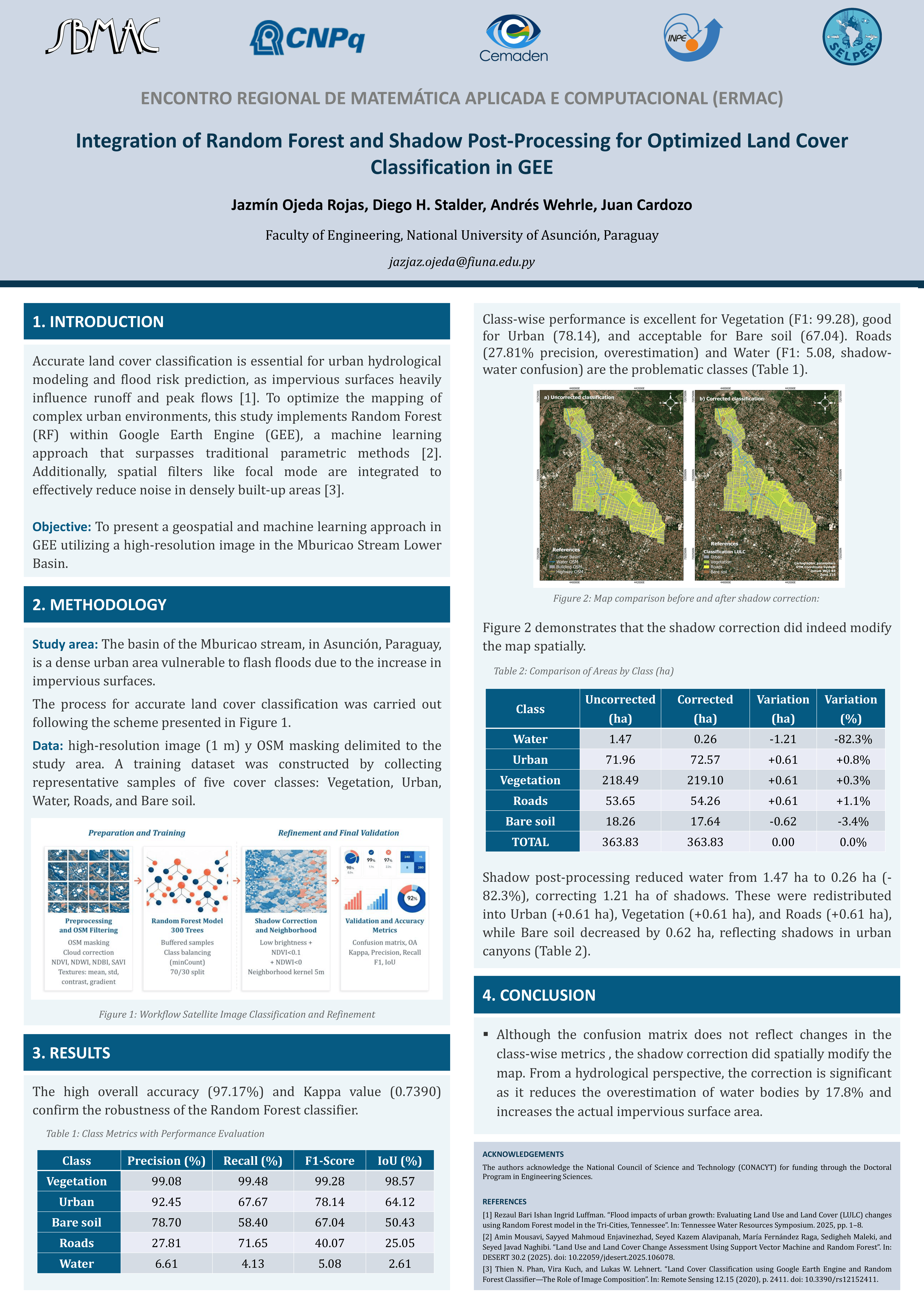
Integrating Random Forest and Shadow Post-processing for Optimized Land Use and Land Cover Classification in GEE
Authors: Jazmin Ojeda Rojas, Diego H. Stalder, Andrés Wehrle, Juan Cardozo
Abstract: This work presents a geospatial processing and machine learning approach for land cover classification in the Mburicao Stream Lower Basin using Google Earth Engine. The methodology uses a Random Forest classifier and a specialized shadow-cleaning routine to correct misclassified shadow pixels. The classification achieved an overall accuracy of 82.55% and a Kappa index of 0.7231. The results show that the lower basin comprises 48.45% vegetation, while impervious surfaces (Urban and Roads) cover nearly half of the total extent, a spatial configuration that accelerates surface runoff and explains the occurrence of flash floods.
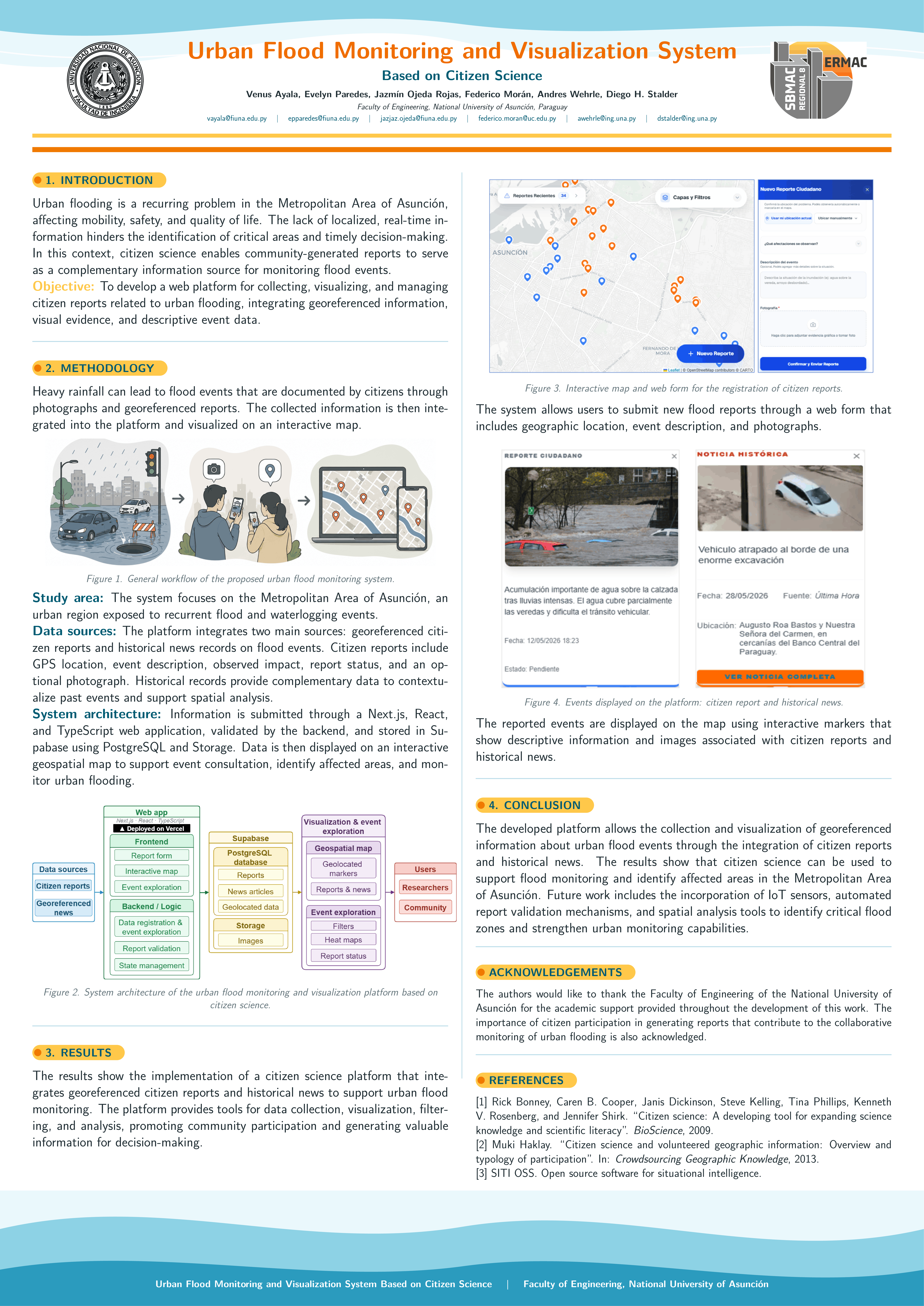
Urban Flood Monitoring and Visualization System Based on Citizen Science
Authors: Venus Ayala, Evelyn Paredes, Diego H. Stalder, Jazmin Ojeda
Abstract: This work proposes the design and implementation of an interactive web platform for urban flood monitoring and visualization based on citizen science. The system enables users to register flood events through web forms, incorporating descriptions, photographs, and geographic location. Developed with Next.js, React, Supabase, and Leaflet, the platform successfully integrates citizen participation with geospatial visualization tools. The system demonstrates the potential of citizen science to complement traditional monitoring systems and support urban risk management associated with flood events.
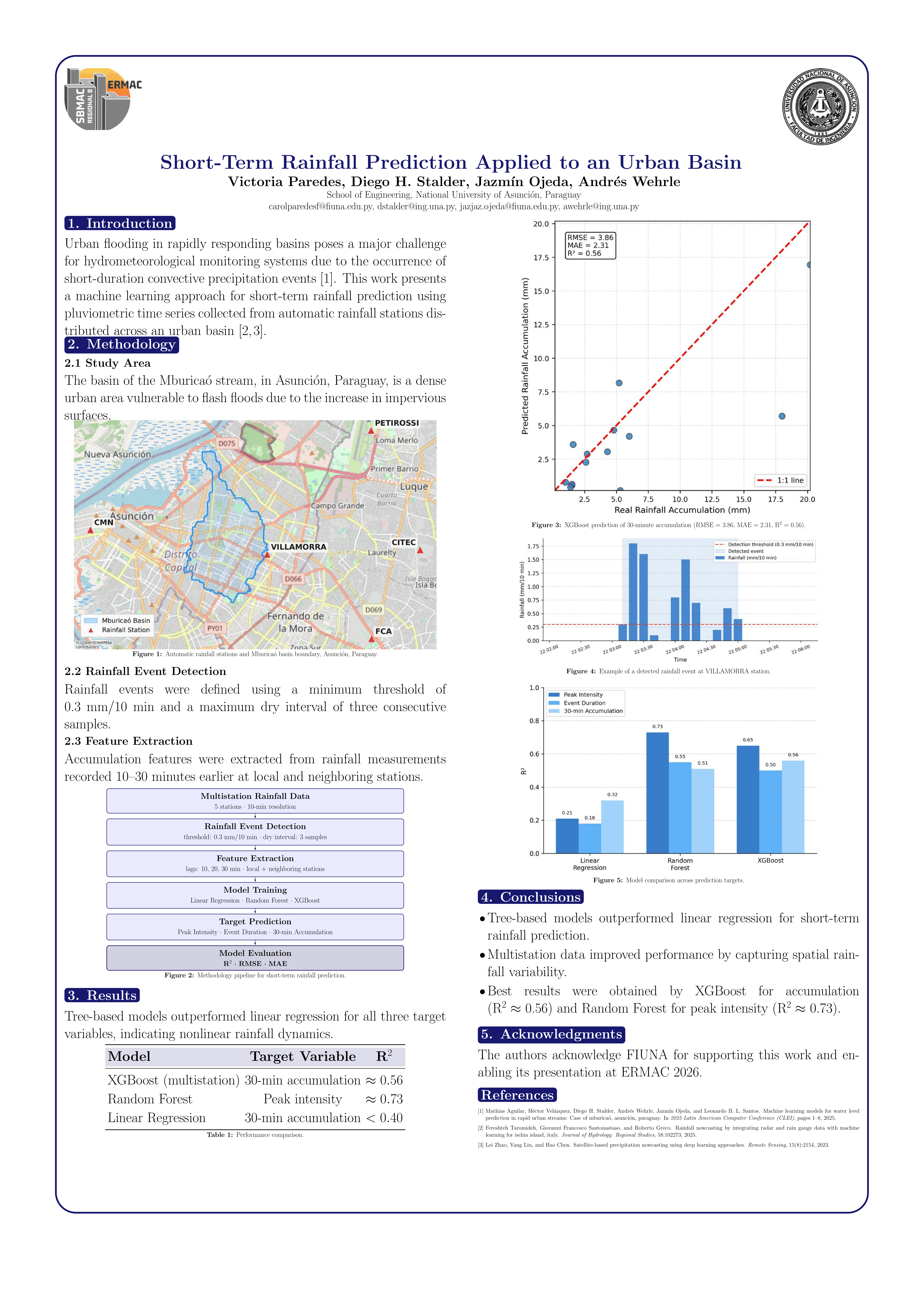
Short-Term Rainfall Prediction Applied to an Urban Basin
Authors: Victoria Paredes, Diego H. Stalder, Jazmin Ojeda, Andrés Wehrle
Abstract: This work presents a machine learning approach for short-term rainfall prediction using pluviometric time series from automatic rainfall stations in an urban basin. Using data from five stations with 10-minute resolution, the study evaluates Linear Regression, Random Forest, and XGBoost models to predict rainfall peak intensity, event duration, and future 30-minute accumulation. Results show that tree-based models (especially XGBoost and Random Forest) outperform linear regression, indicating nonlinear relationships in rainfall dynamics. The multistation XGBoost model achieved an R² ≈ 0.56 for accumulated rainfall prediction.